

Mauritius Island
Early European Colony:
While Arab and Malay sailors knew of Mauritius as early as the 10th century CE and Portuguese sailors first visited it in the 16th century, the island was first colonized in 1638 by the Dutch. Mauritius was populated over the next few centuries by waves of traders, planters and their slaves, indentured laborers, merchants, and artisans. The island was named in honor of Prince Maurice of Nassau by the Dutch, who abandoned the colony in 1710.
Mauritius was visited by the Portuguese between 1507 and 1513.
An official world map by Diogo Ribeiro described “from west to east, the first island, 'Mascarenhas', the second, 'Santa Apolonia' and the third, 'Domingo Friz. The three islands (Réunion, Mauritius, and Rodrigues) were encountered some years earlier by chance during an exploratory expedition of the coast of the Bay of Bengal led by Tristão da Cunha. The expedition ran into a cyclone and was forced to change course. Thus, the ship Cirne of captain Diogo Fernandes Pereira came into view of Réunion island on 9 February 1507. They called the island "Santa Apolonia" ("Saint Apollonia") in honor of that day’s saint. Mauritius was encountered during the same expedition and received the name of "Cirne" and Rodrigues that of "Diogo Fernandes". Five years later, the islands were visited by Dom Pedro de Mascarenhas who left the name Mascarene for the whole region. The Portuguese took no interest in these isolated islands. They were already established in Asia in Goa, on the coast of Malabar, on the island of Ceylon (now Sri Lanka), and on the Malaysian coast.
Their main African base was in Mozambique, therefore the Portuguese navigators preferred to use the Mozambique Channel to go to India. Comoros in the north proved to be a more practical port of call. Thus no permanent colony was established on the island by the Portuguese.
Dutch Mauritius: Dutch map of the coast of Mauritius
In 1598, a Dutch expedition consisting of eight ships, under the orders of admirals Jacques Cornelius van Neck and Wybrandt van Warwick, set sail from the port of Texel, which the Netherlands towards the Indian subcontinent. The eight ships ran into foul weather after passing the Cape of Good Hope and were separated. Three found their way to the northeast of Madagascar, while the remaining five regrouped and sailed in a southeasterly direction. On 17 September, the five ships under the orders of Admiral van Warwick came into view of Mauritius. On 20 September, they entered a sheltered bay that they named "Port de Warwick" (now known as "Grand Port"). They landed and decided to name the island "Prins Maurits van Nassaueiland," afterPrince Maurits (Latin version: Mauritius) of the House of Nassau, the stadtholder of most of the Dutch Republic, and after the main vessel of the fleet, the "Mauritius". From that time, only the name Mauritius has remained. On 2 October, the ships again took to the sea towards Bantam.
From then on, the island’s Port de Warwick was used by the Dutch as a stopover after long months at sea. In 1606, two expeditions came for the first time to what would later become Port-Louis in the northwest part of the island. The expedition, consisting of eleven ships and 1,357 men under the orders of Admiral Corneille, came into the bay, which they named “Rade des Tortues” (literally meaning “Harbor of the Tortoises”) because of the great number of terrestrial tortoises they found there. From that date, Dutch sailors shifted their choice to Rade des Tortues as a harbor.
In 1615, the shipwreck and death of governor Peter Both, who was coming back from India with four richly-laden ships in the bay, led Dutch sailors to consider the route as cursed, and they tried to avoid it as much as possible. In the meantime, the British and the Danes were beginning to make incursions into the Indian Ocean. Those who landed on the island freely cut and took with them the precious heartwood of the ebony trees, then found in profusion all over the island.
Captured by the British:
The French claimed Mauritius in 1715 and renamed it Ile de France. It became a prosperous colony under the French East India Company. The French Government took control in 1767, and the island served as a naval and privateer base during the Napoleonic wars. In 1810, Mauritius was captured by the British, whose possession of the island was confirmed 4 years later by the Treaty of Paris. French institutions, including the Napoleonic code of law, were maintained. The French language is still used more widely than English.
Independence within the commonwealth:
The contest was interpreted locally as a referendum on independence. Sir Seewoosagur Ramgoolam, MLP leader and chief minister in the colonial government, became the first prime minister of independence, on March 12, 1968. This event was preceded by a period of communal strife, brought under control with assistance from British troops. Ramgoolam was awarded the United Nations Prize for the defense of human rights in 1973 for his handling of ethnic tensions between Muslims and Creoles on the islands.
Independence
General elections are held in 1967 and the Front for independence, led by Labor Sir Seewoosagur Ramgoolam, won 54% of the vote and a majority of seats in the Legislative Assembly. In August of the same year, the Legislative Assembly is in favor of independence. PMSD members leave the Chamber in protest before the vote. Mauritius achieved independence on 12 March 1968.
The government that runs the country is a coalition between the Labour Party and the PMSD, his ex-large opponent. What this coalition has imposed against nature? Besides the fact that no party can claim only to win a majority of the population, the leaders understood the need to maintain cooperation with the sugar elite for economic development. Especially within the Labour Party is a number of landowners and merchants Hindus who have common economic interests with the Franco-Mauritian sugar.
Before the coalition between PTr and PMSD, several riots broke out between supporters of the two factions, as in 1965 and 1967, and even requiring the establishment of a state of emergency in the months following independence.
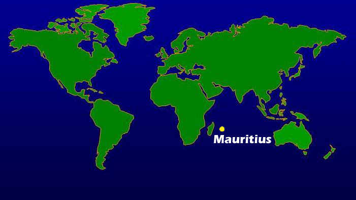
Mauritius is situated in the Indian Ocean.
The area of Mauritius is 2040 km2; its capital city is Port Louis.


DODO

Dutch Map of Mauritius

Indian Ocean old Map

Mauritius old Map